


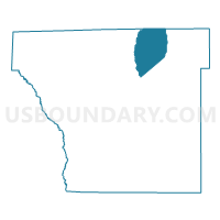
Bowman Voting District, Cleveland County, Arkansas
About
Outline

Summary
| Unique Area Identifier | 526186 |
| Name | Bowman Voting District |
| County | Cleveland County |
| State | Arkansas |
| Area (square miles) | 25.89 |
| Land Area (square miles) | 25.78 |
| Water Area (square miles) | 0.11 |
| % of Land Area | 99.58 |
| % of Water Area | 0.42 |
| Latitude of the Internal Point | 34.01088070 |
| Longtitude of the Internal Point | -92.10424080 |
Maps


Graphs
Select a template below for downloading or customizing gragh for Bowman Voting District, Cleveland County, Arkansas


Neighbors
Neighoring Voting District (by Name) Neighboring Voting District on the Map
- 36 Voting District, Jefferson County, AR
- Miller Voting District, Cleveland County, AR
- Niven Voting District, Cleveland County, AR
- Rison Voting District, Cleveland County, AR
- Whiteville Voting District, Cleveland County, AR
Top 10 Neighboring County Subdivision (by Population) Neighboring County Subdivision on the Map
- Rison township, Cleveland County, AR (1,522)
- Talladega township, Jefferson County, AR (1,267)
- Whiteville township, Cleveland County, AR (957)
- Miller township, Cleveland County, AR (663)
- Bowman township, Cleveland County, AR (530)
- Niven township, Cleveland County, AR (395)
Top 10 Neighboring Unified School District (by Population) Neighboring Unified School District on the Map
- Watson Chapel School District, AR (17,064)
- Cleveland County School District, AR (5,521)
- Woodlawn School District, AR (2,849)